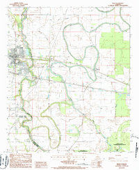
1986 Map of Delhi
USGS Topo · Published 1987About this map
The town of Delhi serves as a primary hub in this mid-1980s landscape, positioned where the Illinois Central Gulf Railroad crosses the winding course of Bayou Macon. The map reveals a transition between the agricultural and industrial activities of the era, marked by a significant Oil and Gas Field extending east toward Altoona. This resource-driven economy is contrasted by the protected wetlands to the south and east, including the northern boundary of the Tensas River National Wildlife Refuge.
Find a feature on this map
32 named features on this map. Tap any name to fly to it.
Don’t see what you’re looking for? This feature index may not catch every label — zoom into the map to look around manually.
Map Details
Editions of this 1986 Delhi Map
This is the sole edition of this map. No revisions or reprints were ever made.
Other maps of this area

1935 · Baskinton
USGS Topo · 1:62,500

1935 · Hurricane
USGS Topo · 1:62,500

1935 · Waverly
USGS Topo · 1:62,500

1955 · Jackson
USGS Topo · 1:250,000

1958 · Baskinton
USGS Topo · 1:62,500

1958 · Hurricane
USGS Topo · 1:62,500

1959 · Mitchiner
USGS Topo · 1:62,500

1961 · Jackson
USGS Topo · 1:250,000

1961 · Waverly
USGS Topo · 1:62,500

1962 · Jackson
USGS Topo · 1:250,000