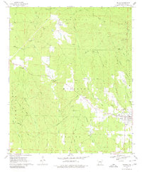
1970 Map of Delight
USGS Topo · Published 1980About this map
Delight serves as the primary hub of this 1970 landscape, where the Missouri Pacific railroad corridor meets the eastern edge of the township. The topography is defined by the winding paths of Saline Creek and Wolf Creek, with the elevation rising toward Red Hill in the north. This survey illustrates a rural community supported by local infrastructure, including a Filtration Plant and Water Tank near the main settlement, and numerous gravel pits scattered throughout the timberland.
Find a feature on this map
37 named features on this map. Tap any name to fly to it.
Don’t see what you’re looking for? This feature index may not catch every label — zoom into the map to look around manually.
Map Details
Editions of this 1970 Delight Map
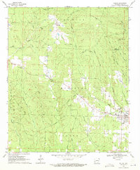
2 editions found
Other maps of this area

1901 · Gurdon
USGS Topo · 1:125,000

1906 · Caddo Gap
USGS Topo · 1:125,000

1943 · Antoine
USGS Topo · 1:62,500

1951 · Pisgah
USGS Topo · 1:24,000

1951 · McCaskill
USGS Topo · 1:24,000

1953 · El Dorado
USGS Topo · 1:250,000

1955 · Little Rock
USGS Topo · 1:250,000

1956 · Little Rock
USGS Topo · 1:250,000

1957 · El Dorado
USGS Topo · 1:250,000

1958 · El Dorado
USGS Topo · 1:250,000