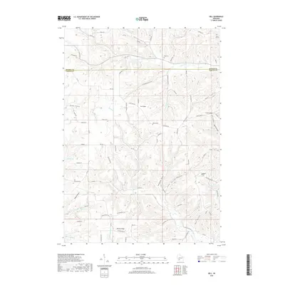
2018 Map of Dell
USGS Topo · Published 2018About this map
Dell sits at a crossroads of narrow valleys and prominent ridges within the Driftless Area, where the boundary between Monroe Co and Vernon Co runs along the high ground of the north. The landscape is defined by its dendritic drainage pattern, where Weister Cr, Upper Brush Cr, and Knapp Cr have carved deep incisions into the plateau. This 2018 survey reveals a rural economy centered on ridge-top roads like Wang Ridge and Irish Ridge Rd, which follow the natural contours of the land to connect disparate farmsteads.
Find a feature on this map
59 named features on this map. Tap any name to fly to it.
Don’t see what you’re looking for? This feature index may not catch every label — zoom into the map to look around manually.
Map Details
Editions of this 2018 Dell Map
This is the sole edition of this map. No revisions or reprints were ever made.
Other maps of this area

1909 · Sparta
USGS Topo · 1:62,500

1916 · Tomah
USGS Topo · 1:62,500

1923 · Viroqua
USGS Topo · 1:62,500

1926 · Viroqua
USGS Topo · 1:62,500

1926 · La Farge
USGS Topo · 1:62,500

1947 · Sparta
USGS Topo · 1:62,500

1949 · Sparta
USGS Topo · 1:62,500

1949 · Tomah
USGS Topo · 1:62,500

1958 · La Crosse
USGS Topo · 1:250,000

1961 · La Crosse
USGS Topo · 1:250,000