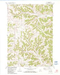
1983 Map of Dell
USGS Topo · Published 1984About this map
Deeply etched ridges and winding creek valleys define this landscape along the Monroe Co Vernon Co line during the early 1980s. The settlement of Dell sits at the junction of Weister Creek and Clark Creek, serving as a central point in an area dominated by rural community life and agricultural infrastructure. Numerous country schools and churches reflect the established social fabric of the townships, including North Clinton Sch, South Clinton Sch, and Sugar Grove Ch.
Find a feature on this map
41 named features on this map. Tap any name to fly to it.
Don’t see what you’re looking for? This feature index may not catch every label — zoom into the map to look around manually.
Map Details
Editions of this 1983 Dell Map
This is the sole edition of this map. No revisions or reprints were ever made.
Other maps of this area

1909 · Sparta
USGS Topo · 1:62,500

1916 · Tomah
USGS Topo · 1:62,500

1923 · Viroqua
USGS Topo · 1:62,500

1926 · Viroqua
USGS Topo · 1:62,500

1926 · La Farge
USGS Topo · 1:62,500

1947 · Sparta
USGS Topo · 1:62,500

1949 · Sparta
USGS Topo · 1:62,500

1949 · Tomah
USGS Topo · 1:62,500

1958 · La Crosse
USGS Topo · 1:250,000

1961 · La Crosse
USGS Topo · 1:250,000