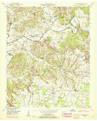
1951 Map of Dellrose
USGS Topo · Published 1967About this map
Elk River meanders across this landscape on the border of Giles Co and Lincoln Co, serving as the primary geographic corridor for agriculture and early industry. The river's influence is evident at Hamilton Mill and Morrell Mill, while the Louisville And Nashville railroad tracks parallel the water, connecting settlements like Dellrose and Wheelerton. This survey, updated with 1960s revisions, reveals a dense network of family and community landmarks, including the Indian Creek School Cem and the Blanche Chapel School Cem. The terrain is characterized by numerous hollows, such as McKinney Hollow and Snow Hollow, which dictated the placement of small rural communities. Cultural hubs like Washington Temple and Kelly Creek Church appear alongside natural features like Smith Cave, illustrating a well-established mid-century rural Tennessee social structure anchored to the creek valleys and river bends.
Find a feature on this map
82 named features on this map. Tap any name to fly to it.
Don’t see what you’re looking for? This feature index may not catch every label — zoom into the map to look around manually.
Map Details
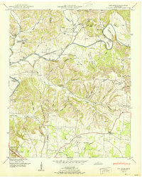
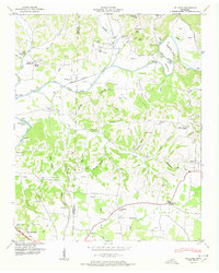
Editions of this 1951 Dellrose Map
3 editions found
Other maps of this area

1888 · Huntsville
USGS Topo · 1:125,000

1892 · Huntsville
USGS Topo · 1:125,000

1936 · Taft
USGS Topo · 1:24,000

1936 · Boonshill
USGS Topo · 1:24,000

1936 · Elkmont
USGS Topo · 1:24,000

1936 · Ardmore
USGS Topo · 1:24,000

1936 · Toney
USGS Topo · 1:24,000

1936 · Tarpley
USGS Topo · 1:24,000

1936 · Elkton
USGS Topo · 1:24,000

1936 · Frankewing
USGS Topo · 1:24,000