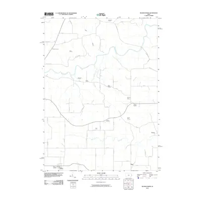
2010 Map of Delmar North
USGS Topo · Published 2010About this map
Saint Patricks Cemetery and the northern reaches of Delmar anchor this Iowa landscape where the rolling agricultural grid is broken by the winding Maquoketa River. The territory is exceptionally dense with small, family-named burial grounds, providing a localized genealogy of the region through sites like the Miller Estate Cemetery, Jessen Farm Cemetery, and Richardson Farm Cemetery. Small rural clusters such as Union Centre, Riggs, and Browns dot the intersections of the township roads, marking the persistent settlement patterns of Clinton County. Significant drainage features like Sugar Creek and Rock Creek flow through the southern half of the quadrangle, while the terrain of Dark Hollow in the north suggests a more complex topography than the surrounding farmland. The map documents the enduring rural character of the area, centered around the Delmar Post Office and a network of secondary roads such as Iron Bridge Rd and Rockdale Rd.
Find a feature on this map
56 named features on this map. Tap any name to fly to it.
Don’t see what you’re looking for? This feature index may not catch every label — zoom into the map to look around manually.
Map Details
Editions of this 2010 Delmar North Map
This is the sole edition of this map. No revisions or reprints were ever made.
Other maps of this area

1891 · DeWitt
USGS Topo · 1:62,500

1891 · Maquoketa
USGS Topo · 1:62,500

1892 · Goose Lake
USGS Topo · 1:62,500

1894 · Goose Lake
USGS Topo · 1:62,500

1899 · Clinton
USGS Topo · 1:125,000

1901 · Peosta
USGS Topo · 1:125,000

1901 · Rock Island
USGS Topo · 1:125,000

1910 · Rock Island
USGS Topo · 1:125,000

1935 · Miles
USGS Topo · 1:62,500

1941 · Miles
USGS Topo · 1:62,500