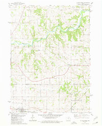
1980 Map of Delmar North
USGS Topo · Published 1981About this map
The Maquoketa River carves a winding path through the northern half of this Jackson County landscape, defining the topography near Dark Hollow and Brush Cr. Further south, the terrain levels out as it approaches the Jackson Co Clinton Co boundary, where the community of Delmar sits at the junction of several rail lines. The Chicago Milwaukee St Paul and Pacific railroad serves as a primary transportation artery, passing through the southern settlements of Delmar and Riggs. This 1980 survey captures a rural Iowa landscape dominated by township divisions like Maquoketa, Fairfield, and Bloomfield. For local historians and genealogists, the map identifies several distinct burial sites including Codfish Cem, Township Cem, Rathbun Cem, and St Patricks Cem. Small-scale industrial activity is evidenced by a quarry located north of the river and another near the southern rail corridor, while Union Centre County Park provides a dedicated recreational space amidst the farmland.
Find a feature on this map
24 named features on this map. Tap any name to fly to it.
Don’t see what you’re looking for? This feature index may not catch every label — zoom into the map to look around manually.
Map Details
Editions of this 1980 Delmar North Map
This is the sole edition of this map. No revisions or reprints were ever made.
Other maps of this area

1891 · DeWitt
USGS Topo · 1:62,500

1891 · Maquoketa
USGS Topo · 1:62,500

1892 · Goose Lake
USGS Topo · 1:62,500

1894 · Goose Lake
USGS Topo · 1:62,500

1899 · Clinton
USGS Topo · 1:125,000

1901 · Peosta
USGS Topo · 1:125,000

1901 · Rock Island
USGS Topo · 1:125,000

1910 · Rock Island
USGS Topo · 1:125,000

1935 · Miles
USGS Topo · 1:62,500

1941 · Miles
USGS Topo · 1:62,500