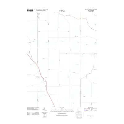
2013 Map of Delmar South
USGS Topo · Published 2013About this map
Welton and Delmar anchor this Clinton County landscape, where the agricultural grid is defined by a dense network of numbered avenues and streets. The terrain is deeply etched by a system of waterways, most notably the meandering Silver Cr and Deep Cr, which dictate the placement of local roads like 7 Day Rd. Along the western edge, the path of Old US Hwy 61 cuts diagonally across the township lines, bypassing the smaller settlement of North Welton. In the northeast, Petersville remains a distinct point of interest amidst the expansive fields. The distribution of these rural centers and the persistence of tributary names like Williams Cr and Negro Cr reflect the long-standing drainage patterns and settlement logic of this part of eastern Iowa.
Find a feature on this map
45 named features on this map. Tap any name to fly to it.
Don’t see what you’re looking for? This feature index may not catch every label — zoom into the map to look around manually.
Map Details
Editions of this 2013 Delmar South Map
This is the sole edition of this map. No revisions or reprints were ever made.
Other maps of this area

1891 · DeWitt
USGS Topo · 1:62,500

1891 · Maquoketa
USGS Topo · 1:62,500

1892 · Goose Lake
USGS Topo · 1:62,500

1894 · Goose Lake
USGS Topo · 1:62,500

1899 · Clinton
USGS Topo · 1:125,000

1901 · Peosta
USGS Topo · 1:125,000

1901 · Rock Island
USGS Topo · 1:125,000

1910 · Rock Island
USGS Topo · 1:125,000

1935 · Miles
USGS Topo · 1:62,500

1941 · Miles
USGS Topo · 1:62,500