
1936 Map of Delmar
USGS Topo · Published 1936About this map
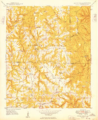
Haleyville serves as the focal point for this 1936 survey, which highlights the town's grid and development within the Black Warrior National Forest. Compiled by the Tennessee Valley Authority and the Geological Survey from aerial photographs, this map documents the critical watershed divide between the Tennessee Basin and neighboring drainages. The infrastructure of the mid-1930s is clearly delineated, from the State Highway No 5 corridor to the industrial presence of the Ala Pwr Co Trans Line. Local history is captured in rural details such as Prospect Ch, a nearby Cem, and the winding course of Quarter Creek. The Divide itself is a prominent landscape feature, influencing both the natural flow of the terrain and the human movement through this part of Winston County during the New Deal era.
Find a feature on this map
9 named features on this map. Tap any name to fly to it.
Don’t see what you’re looking for? This feature index may not catch every label — zoom into the map to look around manually.
Map Details
Editions of this 1936 Delmar Map
This is the sole edition of this map. No revisions or reprints were ever made.
Other maps of this area

1936 · Kinlock Spring
USGS Topo · 1:24,000

1936 · Phil Campbell
USGS Topo · 1:24,000

1936 · Moulton
USGS Topo · 1:48,000

1936 · Goddard
USGS Topo · 1:24,000

1940 · Mt Hope
USGS Topo · 1:62,500

1946 · Phil Campbell
USGS Topo · 1:24,000

1947 · Phil Campbell
USGS Topo · 1:24,000

1947 · Kinlock Spring
USGS Topo · 1:24,000
1949 · Kinlock Spring
USGS Topo · 1:24,000

1956 · Gadsden
USGS Topo · 1:250,000