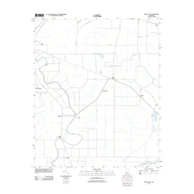
2012 Map of Delta City
USGS Topo · Published 2012About this map
The alluvial landscape of Sharkey County is defined by the winding course of Deer Cr and the Big Sunflower River, which anchor a network of small agricultural communities and family-named landmarks. Settlements such as Delta City, Nitta Yuma, and Panther Burn are connected by a grid of rural roads and drainage bayous, reflecting the region's deep ties to the land. The presence of several historic burial grounds, including Mount Zion Cem, Vickland Cem, and Fish Lake Cem, offers significant research value for genealogists studying the local families of these Delta hamlets. While modern infrastructure like Fish Lake Rd and Durst Rd crisscross the territory, older features like the Old Rail Rd near Shraderville point to the area's former transportation corridors. The map also captures several post offices, including the Po at Delta City, which served as vital community hubs for the surrounding farmsteads.
Find a feature on this map
54 named features on this map. Tap any name to fly to it.
Don’t see what you’re looking for? This feature index may not catch every label — zoom into the map to look around manually.
Map Details
Editions of this 2012 Delta City Map
This is the sole edition of this map. No revisions or reprints were ever made.
Other maps of this area

1939 · Lorenzen
USGS Topo · 1:62,500

1939 · Swan Lake
USGS Topo · 1:62,500

1940 · Auter
USGS Topo · 1:62,500

1953 · Greenwood
USGS Topo · 1:250,000

1955 · Jackson
USGS Topo · 1:250,000

1956 · Greenwood
USGS Topo · 1:250,000

1961 · Jackson
USGS Topo · 1:250,000

1961 · Bayland
USGS Topo · 1:62,500

1962 · Jackson
USGS Topo · 1:250,000

1964 · Lorenzen
USGS Topo · 1:62,500