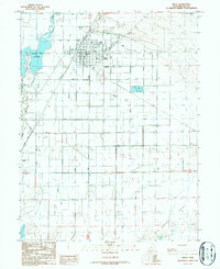
1986 Map of Delta
USGS Topo · Published 1987About this map
Delta serves as the central hub of this agricultural landscape in the mid-1980s, organized by an extensive network of irrigation infrastructure. The Union Pacific railroad bisects the town, connecting the community to larger markets, while the Sevier River feeds into the Gunnison Bend Reservoir to the west. This water system is critical for the surrounding Pahvant Valley, as evidenced by the dense grid of waterways including the Melville Canal, Eliason Canal, and Jensen Canal that transform the arid terrain.
Find a feature on this map
33 named features on this map. Tap any name to fly to it.
Don’t see what you’re looking for? This feature index may not catch every label — zoom into the map to look around manually.
Map Details
Editions of this 1986 Delta Map
This is the sole edition of this map. No revisions or reprints were ever made.
Other maps of this area

1885 · Sevier Desert
USGS Topo · 1:250,000

1951 · Oak City
USGS Topo · 1:62,500

1953 · Delta
USGS Topo · 1:250,000

1958 · Delta
USGS Topo · 1:250,000

1962 · Delta
USGS Topo · 1:250,000

1962 · Holden
USGS Topo · 1:62,500

1962 · Delta
USGS Topo · 1:62,500

1971 · Pavant Butte North
USGS Topo · 1:24,000

1971 · Sunstone Knoll
USGS Topo · 1:24,000
1985 · Harding
USGS Topo · 1:24,000