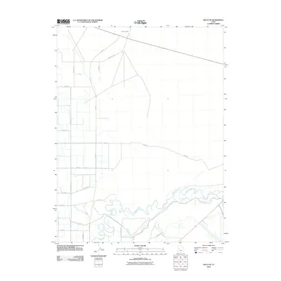
2010 Map of Delta NE
USGS Topo · Published 2010About this map
The Sevier River meanders across this Millard County landscape, defining the character of the terrain northeast of Delta. The river's winding path is contrasted by a rigid grid of rural roads and an extensive network of irrigation infrastructure essential to the region's agricultural viability. Significant water management features include the Terry Ditch and several major canals, specifically Canal A, Canal B, and Canal C, which branch out to support the surrounding fields. To the north, the industrial footprint of the IPP Power Plant stands as a prominent landmark. Local transit is facilitated by a network of named routes such as Jones Rd, N Sugar Factory Rd, and N Sunset Dr, which link the various homesteads and farming operations that characterize this high desert valley during the early twenty-first century.
Find a feature on this map
24 named features on this map. Tap any name to fly to it.
Don’t see what you’re looking for? This feature index may not catch every label — zoom into the map to look around manually.
Map Details
Editions of this 2010 Delta NE Map
This is the sole edition of this map. No revisions or reprints were ever made.
Other maps of this area

1885 · Sevier Desert
USGS Topo · 1:250,000

1951 · Oak City
USGS Topo · 1:62,500

1953 · Delta
USGS Topo · 1:250,000

1958 · Delta
USGS Topo · 1:250,000

1962 · Delta
USGS Topo · 1:250,000

1962 · Lynndyl
USGS Topo · 1:62,500

1962 · Delta
USGS Topo · 1:62,500

1971 · Baker Hot Springs
USGS Topo · 1:24,000

1971 · Rain Lake
USGS Topo · 1:24,000

1979 · Lynndyl
USGS Topo · 1:100,000