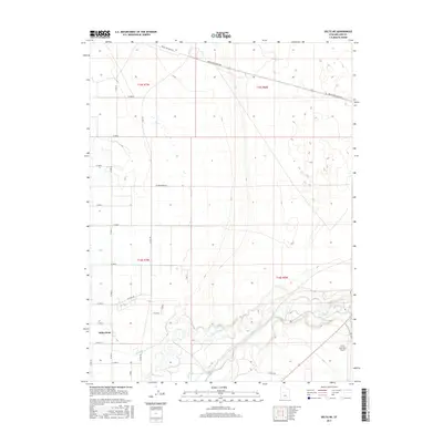
2017 Map of Delta NE
USGS Topo · Published 2017About this map
The Sevier River winds through the southern portion of this Millard County landscape, defining a complex corridor of riparian wetlands and agricultural infrastructure. This 2017 study illustrates the intricate water management system essential to the region, featuring Canal A, Canal B, and Terry Ditch branching off the river's main course. These waterways support the fields surrounding the settlement of Sutherland, where a rigid grid of rural roads like N Jones Rd and W Ashby Rd organizes the desert floor. In the northeast, the industrial footprint of Brush Wellman Rd cuts a long diagonal across the township lines of t15s r6w and t15s r7w. The presence of the Delta Municipal Airport in the southeast corner marks the area's modern connection to the broader Utah territory, contrasting with the ancient, meandering path of the river nearby.
Find a feature on this map
31 named features on this map. Tap any name to fly to it.
Don’t see what you’re looking for? This feature index may not catch every label — zoom into the map to look around manually.
Map Details
Editions of this 2017 Delta NE Map
This is the sole edition of this map. No revisions or reprints were ever made.
Other maps of this area

1885 · Sevier Desert
USGS Topo · 1:250,000

1951 · Oak City
USGS Topo · 1:62,500

1953 · Delta
USGS Topo · 1:250,000

1958 · Delta
USGS Topo · 1:250,000

1962 · Delta
USGS Topo · 1:250,000

1962 · Lynndyl
USGS Topo · 1:62,500

1962 · Delta
USGS Topo · 1:62,500

1971 · Baker Hot Springs
USGS Topo · 1:24,000

1971 · Rain Lake
USGS Topo · 1:24,000

1979 · Lynndyl
USGS Topo · 1:100,000