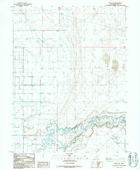
1986 Map of Delta NE
USGS Topo · Published 1987About this map
The Sevier River winds through a landscape defined by desert reclamation and water management in this mid-1980s record of central Utah. The intricate meanders of the river at the southern edge of the sheet contrast sharply with the rigid geometric grid of the surrounding Canal and Canal C systems, which brought irrigation to the arid flats of Millard County. These water works enabled agricultural development near the town of Delta, while uncultivated areas to the east are dominated by shifting Sand Dunes. Industrial and infrastructure development is evident through the presence of a Pumping Station, Substation, and a Gravel Pit. Aviation history is also represented at the Delta Municipal Airport, which includes a specific reference to Aeronica, reflecting the area's role as a regional transportation and service hub for the Great Salt Lake Desert's edge.
Find a feature on this map
13 named features on this map. Tap any name to fly to it.
Don’t see what you’re looking for? This feature index may not catch every label — zoom into the map to look around manually.
Map Details
Editions of this 1986 Delta NE Map
This is the sole edition of this map. No revisions or reprints were ever made.
Other maps of this area

1885 · Sevier Desert
USGS Topo · 1:250,000

1951 · Oak City
USGS Topo · 1:62,500

1953 · Delta
USGS Topo · 1:250,000

1958 · Delta
USGS Topo · 1:250,000

1962 · Delta
USGS Topo · 1:250,000

1962 · Lynndyl
USGS Topo · 1:62,500

1962 · Delta
USGS Topo · 1:62,500

1971 · Baker Hot Springs
USGS Topo · 1:24,000

1971 · Rain Lake
USGS Topo · 1:24,000

1979 · Lynndyl
USGS Topo · 1:100,000