
2016 Map of Deltaville
USGS Topo · Published 2016About this map
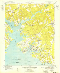
Stingray Point and the neighboring settlement of Deltaville anchor this maritime landscape where the Rappahannock River meets the Chesapeake Bay. The geography is defined by a series of narrow peninsulas and protected harbors, including Fishing Bay and Bushland Creek, which have long supported the region's fishing and boating traditions. To the north, the Lancaster County line crosses the water near Mosquito Island and Windmill Point, while the southern reaches extend to the Mathews County border across Hills Bay. On Gwynn Island, the Gwynn Island Cem and the community of Grimstead represent established local centers. Smaller landings and residential clusters like Amburg, Ruark, and Grinels are connected by a network of coastal roads such as Fishing Bay Rd and Ball Park Rd, illustrating the high density of waterfront development and private docks along the numerous coves and guts.
Find a feature on this map
100 named features on this map. Tap any name to fly to it.
Don’t see what you’re looking for? This feature index may not catch every label — zoom into the map to look around manually.
Map Details
Editions of this 2016 Deltaville Map
This is the sole edition of this map. No revisions or reprints were ever made.
Other maps of this area

1916 · Kilmarnock
USGS Topo · 1:48,000

1916 · Mathews
USGS Topo · 1:62,500

1917 · Kilmarnock
USGS Topo · 1:62,500

1917 · Mathews
USGS Topo · 1:62,500

1942 · Kilmarnock
USGS Topo · 1:62,500

1943 · Richmond
USGS Topo · 1:250,000

1948 · Ware Neck
USGS Topo · 1:24,000

1948 · Deltaville
USGS Topo · 1:24,000

1948 · Mathews
USGS Topo · 1:24,000
1949 · Irvington
USGS Topo · 1:24,000