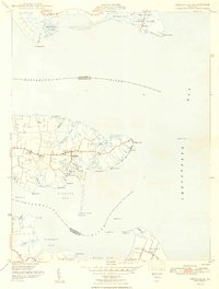
1948 Map of Deltaville
USGS Topo · Published 1948About this map
Deltaville and its surrounding Middle Peninsula neck of land are defined by a complex network of tidal creeks and bays where the Rappahannock River meets the Chesapeake Bay. This maritime landscape reflects the era's reliance on water for transit and trade, with numerous beacons and lights such as Stingray Point LH and Jackson Creek Lt guiding vessels into protected harbors like Fishing Bay and Broad Creek. Across the Piankatank River, the map captures the northern tip of Gwynn Island and the settlement of Grimstead, showing a pattern of coastal development where small communities like Amburg and Ruark cluster near the heads of navigable creeks. The prominence of numerous bench marks and survey control points from the Jackson and Boss stations highlights the intensive geodetic work required to map this jagged, marshy shoreline accurately.
Find a feature on this map
61 named features on this map. Tap any name to fly to it.
Don’t see what you’re looking for? This feature index may not catch every label — zoom into the map to look around manually.
Map Details
Editions of this 1948 Deltaville Map
2 editions found
Other maps of this area

1916 · Kilmarnock
USGS Topo · 1:48,000

1916 · Mathews
USGS Topo · 1:62,500

1917 · Kilmarnock
USGS Topo · 1:62,500

1917 · Mathews
USGS Topo · 1:62,500

1942 · Kilmarnock
USGS Topo · 1:62,500

1943 · Richmond
USGS Topo · 1:250,000

1948 · Ware Neck
USGS Topo · 1:24,000

1948 · Deltaville
USGS Topo · 1:24,000

1948 · Mathews
USGS Topo · 1:24,000
1949 · Irvington
USGS Topo · 1:24,000