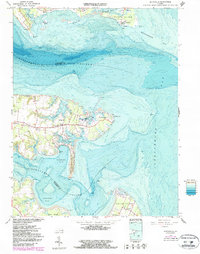
1964 Map of Deltaville
USGS Topo · Published 1987About this map
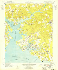
Stingray Point and the narrow peninsula of Stovepoint Neck define this maritime landscape where the Rappahannock River and Piankatank River meet the Chesapeake Bay. The map documents a coastal community deeply tied to its waterways, centered on the settlement of Deltaville. Dense hydrographic data reveals the shifting shoals of the Spit and the bathymetry of Fishing Bay, providing a detailed look at the underwater topography as it existed in the mid-1960s.
Find a feature on this map
52 named features on this map. Tap any name to fly to it.
Don’t see what you’re looking for? This feature index may not catch every label — zoom into the map to look around manually.
Map Details
Editions of this 1964 Deltaville Map
4 editions found
Other maps of this area

1916 · Kilmarnock
USGS Topo · 1:48,000

1916 · Mathews
USGS Topo · 1:62,500

1917 · Kilmarnock
USGS Topo · 1:62,500

1917 · Mathews
USGS Topo · 1:62,500

1942 · Kilmarnock
USGS Topo · 1:62,500

1943 · Richmond
USGS Topo · 1:250,000

1948 · Ware Neck
USGS Topo · 1:24,000

1948 · Deltaville
USGS Topo · 1:24,000

1948 · Mathews
USGS Topo · 1:24,000
1949 · Irvington
USGS Topo · 1:24,000