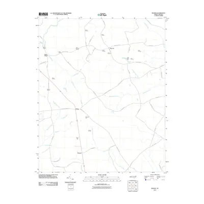
2010 Map of Delway
USGS Topo · Published 2010About this map
Taylors Bridge and Waycross anchor this Sampson County landscape, where family heritage is deeply etched into the geography through numerous private burial grounds. Small settlements like Delway and Shanghai are connected by a network of rural roads such as Rogers Mill Rd and W Magnolia Lisbon Rd. The terrain is defined by low-lying wetlands and drainage basins, most notably Harvells Bay and Pig in Bay, which feed into local waterways like Quehiffle Creek and Doctors Creek.
Find a feature on this map
61 named features on this map. Tap any name to fly to it.
Don’t see what you’re looking for? This feature index may not catch every label — zoom into the map to look around manually.
Map Details
Editions of this 2010 Delway Map
This is the sole edition of this map. No revisions or reprints were ever made.
Other maps of this area

1953 · Florence
USGS Topo · 1:250,000

1954 · Florence
USGS Topo · 1:250,000

1954 · White Lake
USGS Topo · 1:62,500

1955 · Atkinson
USGS Topo · 1:62,500

1959 · Garland
USGS Topo · 1:62,500

1962 · Rose Hill
USGS Topo · 1:62,500

1982 · Elizabethtown
USGS Topo · 1:100,000
1984 · Harrells
USGS Topo · 1:24,000
1984 · Delway
USGS Topo · 1:24,000
1984 · Rose Hill
USGS Topo · 1:24,000