
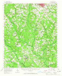
1959 Map of Garland
USGS Topo · Published 1960About this map
Clinton and Garland anchor this detailed look at central Sampson County in the late 1950s, a landscape defined by the winding course of South Swamp and Great Coharie Creek. The Atlantic Coast Line railroad cuts a diagonal path through the terrain, connecting smaller communities like Roseboro and Parkersburg to the regional hubs. The sheet reveals a dense network of country churches and rural schools, such as Andrews Chapel, Smith Chapel, and the Ingold-Taylors Bridge Sch, which served as vital community centers for scattered farmsteads.
Find a feature on this map
96 named features on this map. Tap any name to fly to it.
Don’t see what you’re looking for? This feature index may not catch every label — zoom into the map to look around manually.
Map Details
Editions of this 1959 Garland Map
2 editions found
Other maps of this area

1909 · Coharie
USGS Topo · 1:62,500

1953 · Florence
USGS Topo · 1:250,000

1953 · Raleigh
USGS Topo · 1:250,000

1954 · Florence
USGS Topo · 1:250,000

1954 · Raleigh
USGS Topo · 1:250,000

1954 · White Lake
USGS Topo · 1:62,500

1955 · Atkinson
USGS Topo · 1:62,500

1955 · Elizabethtown
USGS Topo · 1:62,500

1959 · Roseboro
USGS Topo · 1:62,500

1962 · Rose Hill
USGS Topo · 1:62,500