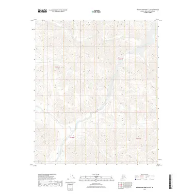
2018 Map of Demarcation Point A-2 SW
USGS Topo · Published 2018About this map
The Kongakut River dominates this remote landscape in the North Slope Borough, carving a path through terrain defined by high-elevation contours and seasonal waterways like the Drain. This 2018 survey provides an exact record of the hydraulic patterns and topographical changes in the northern reaches of Alaska, far above the Arctic Circle. The map reveals the intricate network of drainage basins and ridges within the public land survey system blocks, including t4s r41e and t5s r42e. The absence of roads or permanent structures underscores the wilderness character of this region, which remains primarily under the jurisdiction of federal land management agencies.
Find a feature on this map
6 named features on this map. Tap any name to fly to it.
Don’t see what you’re looking for? This feature index may not catch every label — zoom into the map to look around manually.
Map Details
Editions of this 2018 Demarcation Point A-2 SW Map
This is the sole edition of this map. No revisions or reprints were ever made.
Other maps of this area

1951 · Demarcation Point
USGS Topo · 1:250,000

1951 · Table Mountain
USGS Topo · 1:250,000

1955 · Demarcation Point
USGS Topo · 1:250,000

1956 · Table Mountain
USGS Topo · 1:250,000

1964 · Table Mountain
USGS Topo · 1:250,000

1964 · Demarcation Point
USGS Topo · 1:250,000

1983 · Table Mountain D-2
USGS Topo · 1:63,360

1983 · Demarcation Point A-2
USGS Topo · 1:63,360
1983 · Table Mountain D-3
USGS Topo · 1:63,360
1983 · Demarcation Point A-3
USGS Topo · 1:63,360