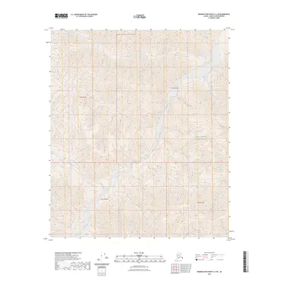
2023 Map of Demarcation Point A-2 SW
USGS Topo · Published 2023About this map
Kongakut River winds through the northern reaches of the Brooks Range, carving a complex path through this corner of the Arctic National Wildlife Refuge. The landscape is dominated by the steep elevation changes characteristic of the Mollie Beattie Wilderness, where the braided river channels and the tributary waters of Drain Creek provide the only breaks in the dense contour lines. This 2023 survey illustrates a wilderness nearly untouched by human infrastructure, lacking roads, buildings, or improved trails. The map serves as a primary record of the hydrological patterns and topographical relief in one of the most protected environments in Alaska, capturing the raw state of the tundra and mountains as they transition toward the Beaufort Sea.
Find a feature on this map
8 named features on this map. Tap any name to fly to it.
Don’t see what you’re looking for? This feature index may not catch every label — zoom into the map to look around manually.
Map Details
Editions of this 2023 Demarcation Point A-2 SW Map
This is the sole edition of this map. No revisions or reprints were ever made.
Other maps of this area

1951 · Demarcation Point
USGS Topo · 1:250,000

1951 · Table Mountain
USGS Topo · 1:250,000

1955 · Demarcation Point
USGS Topo · 1:250,000

1956 · Table Mountain
USGS Topo · 1:250,000

1964 · Table Mountain
USGS Topo · 1:250,000

1964 · Demarcation Point
USGS Topo · 1:250,000

1983 · Table Mountain D-2
USGS Topo · 1:63,360

1983 · Demarcation Point A-2
USGS Topo · 1:63,360
1983 · Table Mountain D-3
USGS Topo · 1:63,360
1983 · Demarcation Point A-3
USGS Topo · 1:63,360