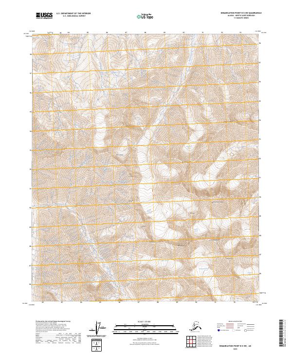
2023 Map of Demarcation Point B-5 SW
USGS Topo · Published 2023About this map
Mt McCall and Mt Hubley tower over a high-altitude landscape defined by an extensive network of ice fields and alpine drainages in the North Slope Borough. This 2023 survey by the U.S. Geological Survey reveals a complex glacial system where the McCall Glacier and Hubley Glacier feed into northward-flowing waters like McCall Creek. The terrain is punctuated by sharp landmarks such as Wolverine Crags and Schwanda Peak, while narrow transit points like Bravo Pass navigate between the massive Bravo Glacier and Schwanda Glacier. The concentration of named peaks—including Mt Deliverance, Mt Suki, and Mt Waw—reflects the importance of this region for geographic orientation in the remote Brooks Range. This map provides a precise contemporary look at the extent of ice features such as Contact Glacier and Arey Glacier and their associated meltwater paths like Arey Creek and Okpilakruak Creek.
Find a feature on this map
23 named features on this map. Tap any name to fly to it.
Don’t see what you’re looking for? This feature index may not catch every label — zoom into the map to look around manually.
Map Details
Editions of this 2023 Demarcation Point B-5 SW Map
This is the sole edition of this map. No revisions or reprints were ever made.
Other maps of this area

1951 · Demarcation Point
USGS Topo · 1:250,000

1951 · Mt. Michelson
USGS Topo · 1:250,000

1955 · Demarcation Point
USGS Topo · 1:250,000

1955 · Mount Michelson B-1
USGS Topo · 1:63,360

1956 · Mt. Michelson
USGS Topo · 1:250,000

1956 · Demarcation Point B-5
USGS Topo · 1:63,360

1964 · Demarcation Point
USGS Topo · 1:250,000
1983 · Demarcation Point A-5
USGS Topo · 1:63,360
1983 · Mount Michelson A-1
USGS Topo · 1:63,360
2018 · Demarcation Point B-5 SE
USGS Topo · 1:25,000