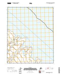
2018 Map of Demarcation Point D-3 NE
USGS Topo · Published 2018About this map
The Beaufort Sea shoreline defines this Arctic landscape where the land meets the water along the northern coast of Alaska. The map illustrates a complex network of coastal features, including the protected waters of Angun Lagoon and Beaufort Lagoon, which are sheltered from the open sea by narrow barrier strips and points of land. These lagoons are fed by the meandering courses of the Sikrelurak River and Angun River, indicating a highly fluid environment where freshwater drainage interacts with the tidal influences of the Nuvagapak Entrance.
Find a feature on this map
11 named features on this map. Tap any name to fly to it.
Don’t see what you’re looking for? This feature index may not catch every label — zoom into the map to look around manually.
Map Details
Editions of this 2018 Demarcation Point D-3 NE Map
This is the sole edition of this map. No revisions or reprints were ever made.
Other maps of this area

1951 · Barter Island
USGS Topo · 1:250,000

1951 · Demarcation Point
USGS Topo · 1:250,000

1955 · Demarcation Point
USGS Topo · 1:250,000

1955 · Demarcation Point D-3
USGS Topo · 1:63,360

1955 · Demarcation Point D-2
USGS Topo · 1:63,360
1955 · Barter Island A-3
USGS Topo · 1:63,360

1959 · Barter Island
USGS Topo · 1:250,000

1962 · Demarcation Point D-3
USGS Topo · 1:50,000

1964 · Demarcation Point
USGS Topo · 1:250,000
1964 · Barter Island
USGS Topo · 1:250,000