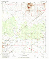
1965 Map of Deming East
USGS Topo · Published 1984About this map
The high desert landscape of Luna County is defined by the convergence of major rail corridors and the seasonal Mimbres River. During the mid-1960s, Deming served as a vital regional hub, situated at the junction of the Atchison Topeka and Santa Fe and Southern Pacific railroads. The town's eastern expansion is marked by the Rio Mimbres Country Club, the Mountain View Cem, and the Southwestern New Mexico State Fairground, reflecting a period of established civic and recreational growth.
Find a feature on this map
28 named features on this map. Tap any name to fly to it.
Don’t see what you’re looking for? This feature index may not catch every label — zoom into the map to look around manually.
Map Details
Editions of this 1965 Deming East Map
2 editions found
Other maps of this area

1899 · Deming
USGS Topo · 1:125,000

1915 · Deming
USGS Topo · 1:125,000

1955 · Las Cruces
USGS Topo · 1:250,000

1958 · Las Cruces
USGS Topo · 1:250,000

1964 · Goat Ridge
USGS Topo · 1:24,000

1964 · Florida
USGS Topo · 1:24,000

1964 · Deming West
USGS Topo · 1:24,000

1964 · Massacre Peak
USGS Topo · 1:24,000

1964 · Florida Gap
USGS Topo · 1:24,000

1965 · Deming East
USGS Topo · 1:24,000