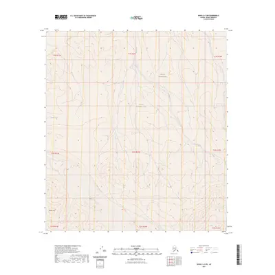
2023 Map of Denali A-3 NW
USGS Topo · Published 2023About this map
Denali National Park and the adjacent Denali Wilderness define this high-altitude landscape in the Alaska interior. The terrain is dominated by the winding path of Birch Creek, which cuts through the central and eastern portions of the quadrangle, joined by tributaries like Haul Creek in the northwest. This 2023 survey illustrates the modern boundaries and preserved state of these federal lands, showing a landscape largely free of permanent human infrastructure or settlements. Spyglass Hill stands as a prominent elevation marker in the southwest corner, offering a reference point for navigating the complex contours of the Denali region. The map provides an essential record of the natural hydrography and topography within one of America's most protected wilderness areas.
Find a feature on this map
14 named features on this map. Tap any name to fly to it.
Don’t see what you’re looking for? This feature index may not catch every label — zoom into the map to look around manually.
Map Details
Editions of this 2023 Denali A-3 NW Map
This is the sole edition of this map. No revisions or reprints were ever made.
Other maps of this area

1952 · Mount McKinley
USGS Topo · 1:250,000

1953 · Mount McKinley B-4
USGS Topo · 1:63,360

1953 · Mount McKinley B-3
USGS Topo · 1:63,360

1953 · Mount McKinley A-4
USGS Topo · 1:63,360

1954 · Mount McKinley A-4
USGS Topo · 1:63,360

1954 · Mount McKinley B-3
USGS Topo · 1:63,360

1954 · Mount McKinley A-3
USGS Topo · 1:63,360

1958 · Mount McKinley
USGS Topo · 1:250,000

1969 · Mount McKinley
USGS Topo · 1:250,000
2015 · Denali A-4 SE
USGS Topo · 1:25,000