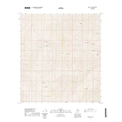
2023 Map of Denali A-3 SE
USGS Topo · Published 2023About this map
Denali dominates this high-altitude survey of the Alaska Range, capturing the massive verticality of the summit and its surrounding technical features. The map documents the primary climbing routes and geological landmarks that define the massif, including the famous West Buttress and the steep Wickersham Wall to the north. As part of both the Denali Wilderness and Denali National Park, this terrain is characterized by massive ice fields and high passes such as Kahiltna Pass and Denali Pass. Named features like Churchill Peaks, Archdeacons Tower, and the distinct North Peak and South Peak provide specific reference points for the highest reaches of the continent. The southern portion of the sheet transitions toward the Kahiltna Peaks and the lower stretches of the South Buttress, illustrating the complex glacial environment and the sheer scale of the peak's northern and southern flanks.
Find a feature on this map
25 named features on this map. Tap any name to fly to it.
Don’t see what you’re looking for? This feature index may not catch every label — zoom into the map to look around manually.
Map Details
Editions of this 2023 Denali A-3 SE Map
This is the sole edition of this map. No revisions or reprints were ever made.
Other maps of this area

1950 · Talkeetna
USGS Topo · 1:250,000

1951 · Talkeetna
USGS Topo · 1:250,000

1952 · Mount McKinley
USGS Topo · 1:250,000

1954 · Mount McKinley A-2
USGS Topo · 1:63,360

1954 · Mount McKinley A-3
USGS Topo · 1:63,360

1958 · Talkeetna D-2
USGS Topo · 1:63,360

1958 · Talkeetna D-3
USGS Topo · 1:63,360

1958 · Talkeetna
USGS Topo · 1:250,000

1958 · Mount McKinley
USGS Topo · 1:250,000

1965 · Talkeetna
USGS Topo · 1:250,000