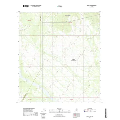
2017 Map of Denali A-5 NW
USGS Topo · Published 2017About this map
Denali National Preserve and Denali National Park meet at the boundary of the Yukon-Koyukuk Census Area and Denali Borough in this high-latitude Alaskan survey. The landscape is defined by its complex drainage network, where the Swift Fork and Boulder Cr navigate the southern terrain, while the Fish River and Dry Cr cross the central and northern reaches. Rising in the northeast, the Cottonwood Hills provide a distinct topographic contrast to the surrounding river basins. This map illustrates the intersection of major conservation boundaries during the early 21st century, revealing the natural hydrology of the interior before it reaches the Highpower Cr drainage system. The absence of roads or permanent structures emphasizes the character of this protected wilderness.
Find a feature on this map
15 named features on this map. Tap any name to fly to it.
Don’t see what you’re looking for? This feature index may not catch every label — zoom into the map to look around manually.
Map Details
Editions of this 2017 Denali A-5 NW Map
This is the sole edition of this map. No revisions or reprints were ever made.
Other maps of this area

1952 · Mount McKinley
USGS Topo · 1:250,000

1952 · Mount McKinley A-5
USGS Topo · 1:63,360

1953 · Mount McKinley B-5
USGS Topo · 1:63,360

1954 · Mount McKinley B-5
USGS Topo · 1:63,360

1954 · Mount McKinley A-5
USGS Topo · 1:63,360

1958 · Mount McKinley B-6
USGS Topo · 1:63,360

1958 · Mount McKinley A-6
USGS Topo · 1:63,360

1958 · Mount McKinley
USGS Topo · 1:250,000

1969 · Mount McKinley
USGS Topo · 1:250,000
2017 · Denali B-5 SW
USGS Topo · 1:25,000