
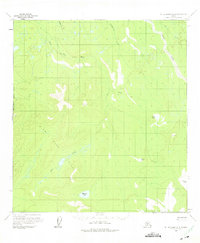
1958 Map of Mount McKinley A-6
USGS Topo · Published 1965About this map
Winter Trail tracks across the central landscape of this interior Alaska region, marking a vital seasonal transportation route between river systems during the late 1950s. The hydrography is dominated by the sprawling tributaries of the Swift Fork and the Slow Fork of the Kuskokwim River, which wind through a mosaic of lakes and low-lying marshes. Named bodies of water like Haines Lake, Giles Lake, and Barren Lake punctuate the drainage basins, providing critical landmarks in a wilderness largely devoid of permanent settlements. Minor elevations are identified by succinct labels such as Bulb, Agnes, and Shrew, while the West Boundary Fairbanks Meridian establishes the formal surveying framework for this remote territory. The map illustrates a period before significant infrastructure reached this part of the Yukon-Koyukuk region, emphasizing the reliance on natural waterways like Telidaside Creek and Middle Cr for navigation.
Find a feature on this map
16 named features on this map. Tap any name to fly to it.
Don’t see what you’re looking for? This feature index may not catch every label — zoom into the map to look around manually.
Map Details
Editions of this 1958 Mount McKinley A-6 Map
2 editions found
Other maps of this area

1949 · McGrath
USGS Topo · 1:250,000

1950 · Medfra
USGS Topo · 1:250,000

1950 · McGrath
USGS Topo · 1:250,000

1950 · Talkeetna
USGS Topo · 1:250,000

1951 · Talkeetna
USGS Topo · 1:250,000

1952 · Mount McKinley
USGS Topo · 1:250,000

1952 · Mount McKinley A-5
USGS Topo · 1:63,360

1953 · Mount McKinley B-5
USGS Topo · 1:63,360

1954 · Mount McKinley B-5
USGS Topo · 1:63,360

1954 · Mount McKinley A-5
USGS Topo · 1:63,360