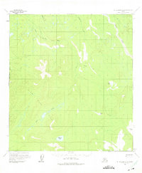
1958 Map of Mount McKinley A-6
USGS Topo · Published 1975About this map
Swift Fork and the winding Slow Fork rivers dominate this interior Alaskan landscape, surveyed in the mid-1950s. The region is defined by its complex drainage systems, where Middle Cr, Telidaside Creek, and Dry Creek feed into larger glacial-fed watercourses. This area remained largely untracked by permanent roads at the time of the survey, relying instead on seasonal routes such as the Winter Trail which cuts across the northern and central sections of the quadrangle.
Find a feature on this map
13 named features on this map. Tap any name to fly to it.
Don’t see what you’re looking for? This feature index may not catch every label — zoom into the map to look around manually.
Map Details
Editions of this 1958 Mount McKinley A-6 Map
2 editions found

Other maps of this area

1949 · McGrath
USGS Topo · 1:250,000

1950 · Medfra
USGS Topo · 1:250,000

1950 · McGrath
USGS Topo · 1:250,000

1950 · Talkeetna
USGS Topo · 1:250,000

1951 · Talkeetna
USGS Topo · 1:250,000

1952 · Mount McKinley
USGS Topo · 1:250,000

1952 · Mount McKinley A-5
USGS Topo · 1:63,360

1953 · Mount McKinley B-5
USGS Topo · 1:63,360

1954 · Mount McKinley B-5
USGS Topo · 1:63,360

1954 · Mount McKinley A-5
USGS Topo · 1:63,360