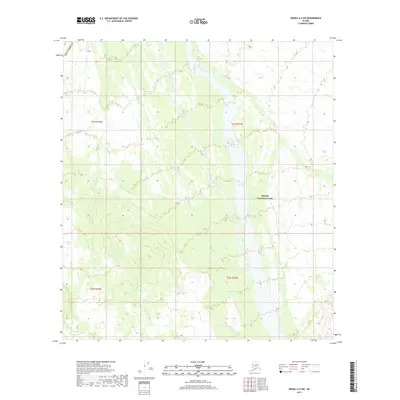
2017 Map of Denali A-5 SW
USGS Topo · Published 2017About this map
Denali National Park and the rugged interior of the Denali Borough define this portion of the Alaska Range wilderness. The landscape is dominated by the complex hydrological network of the Swift Fork, which meanders through a broad valley floor, and the tributary system of Boulder Creek. To the west, the topography rises sharply toward the high ridges overlooking Grizzly Lake. This survey illustrates the protected status of the land, showing how the national park boundary intersects with township lines like t21s r25w and t22s r25w. The absence of developed roads or settlements highlights the isolation of this terrain, where the movement of water across the glacial till remains the primary influence on the land's character.
Find a feature on this map
9 named features on this map. Tap any name to fly to it.
Don’t see what you’re looking for? This feature index may not catch every label — zoom into the map to look around manually.
Map Details
Editions of this 2017 Denali A-5 SW Map
This is the sole edition of this map. No revisions or reprints were ever made.
Other maps of this area

1950 · Talkeetna
USGS Topo · 1:250,000

1951 · Talkeetna
USGS Topo · 1:250,000

1952 · Mount McKinley
USGS Topo · 1:250,000

1952 · Mount McKinley A-5
USGS Topo · 1:63,360

1954 · Mount McKinley A-5
USGS Topo · 1:63,360

1958 · Talkeetna D-6
USGS Topo · 1:63,360

1958 · Talkeetna D-5
USGS Topo · 1:63,360

1958 · Talkeetna
USGS Topo · 1:250,000

1958 · Mount McKinley A-6
USGS Topo · 1:63,360

1958 · Mount McKinley
USGS Topo · 1:250,000