
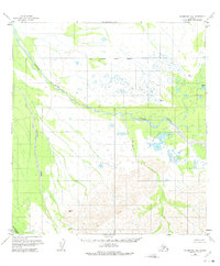
1958 Map of Talkeetna D-6
USGS Topo · Published 1961About this map
The East Fork Kuskokwim River dominates this mid-century landscape in the Alaska interior, its braided channels weaving through a network of waterways and wetlands. Surveyed during the late 1950s, the map reveals a remote terrain defined by the Pingston Creek and Red Paint Creek systems. A rare sign of human activity appears near the Amos Lakes where Ruins are noted, providing a specific point of interest for those tracing early bush settlements or archaeological sites. To the south, the terrain rises sharply toward high-altitude survey points like VABM 3392 Ton and VABM 2470 Plus, overlooking the Tonzona River valley. The map is a product of aerial photogrammetry from the early 1950s, capturing the natural drainage patterns of Scotty Lake and its surroundings before any modern development altered the wilderness.
Find a feature on this map
10 named features on this map. Tap any name to fly to it.
Don’t see what you’re looking for? This feature index may not catch every label — zoom into the map to look around manually.
Map Details
Editions of this 1958 Talkeetna D-6 Map
2 editions found
Other maps of this area

1949 · McGrath
USGS Topo · 1:250,000

1950 · Medfra
USGS Topo · 1:250,000

1950 · McGrath
USGS Topo · 1:250,000

1950 · Talkeetna
USGS Topo · 1:250,000

1951 · Talkeetna
USGS Topo · 1:250,000

1952 · Mount McKinley
USGS Topo · 1:250,000

1952 · Mount McKinley A-5
USGS Topo · 1:63,360

1954 · Mount McKinley A-5
USGS Topo · 1:63,360

1958 · Talkeetna C-6
USGS Topo · 1:63,360

1958 · Talkeetna D-5
USGS Topo · 1:63,360