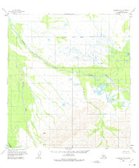
1958 Map of Talkeetna D-6
USGS Topo · Published 1975About this map
Tonzona River dominates this interior Alaskan landscape, meandering through a wide glacial valley during the mid-twentieth century. The map reveals a complex drainage system where the Pingston Creek and Little Tonzona River converge toward the northern flats. A notable indicator of past human activity is recorded near Amos Lakes, where Ruins are identified north of a prominent bend in the river.
Find a feature on this map
11 named features on this map. Tap any name to fly to it.
Don’t see what you’re looking for? This feature index may not catch every label — zoom into the map to look around manually.
Map Details
Editions of this 1958 Talkeetna D-6 Map
2 editions found
Other maps of this area

1949 · McGrath
USGS Topo · 1:250,000

1950 · Medfra
USGS Topo · 1:250,000

1950 · McGrath
USGS Topo · 1:250,000

1950 · Talkeetna
USGS Topo · 1:250,000

1951 · Talkeetna
USGS Topo · 1:250,000

1952 · Mount McKinley
USGS Topo · 1:250,000

1952 · Mount McKinley A-5
USGS Topo · 1:63,360

1954 · Mount McKinley A-5
USGS Topo · 1:63,360

1958 · Talkeetna D-6
USGS Topo · 1:63,360

1958 · Talkeetna C-6
USGS Topo · 1:63,360