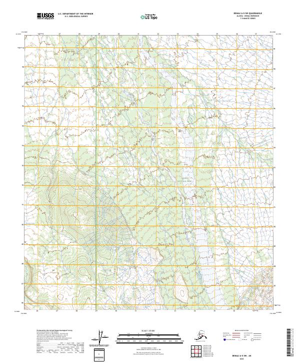
2023 Map of Denali A-5 SW
USGS Topo · Published 2023About this map
Denali National Park encompasses a significant portion of this interior Alaskan landscape, where the drainage patterns of the Swift Fork and Boulder Creek define the topography. The map illustrates a high-altitude wilderness shaped by glaciation and alpine hydrology, including the remote waters of Grizzly Lake in the southwestern quadrant. While much of the terrain remains undeveloped, the intricate contour data reveals the complex ridgelines and valleys characteristic of the Alaska Range's northern foothills. This 2023 survey serves as a modern record of the natural boundaries and watercourses within the park's protected interior, highlighting the vast, roadless character of the Denali Borough.
Find a feature on this map
8 named features on this map. Tap any name to fly to it.
Don’t see what you’re looking for? This feature index may not catch every label — zoom into the map to look around manually.
Map Details
Editions of this 2023 Denali A-5 SW Map
This is the sole edition of this map. No revisions or reprints were ever made.
Other maps of this area

1950 · Talkeetna
USGS Topo · 1:250,000

1951 · Talkeetna
USGS Topo · 1:250,000

1952 · Mount McKinley
USGS Topo · 1:250,000

1952 · Mount McKinley A-5
USGS Topo · 1:63,360

1954 · Mount McKinley A-5
USGS Topo · 1:63,360

1958 · Talkeetna D-6
USGS Topo · 1:63,360

1958 · Talkeetna D-5
USGS Topo · 1:63,360

1958 · Talkeetna
USGS Topo · 1:250,000

1958 · Mount McKinley A-6
USGS Topo · 1:63,360

1958 · Mount McKinley
USGS Topo · 1:250,000