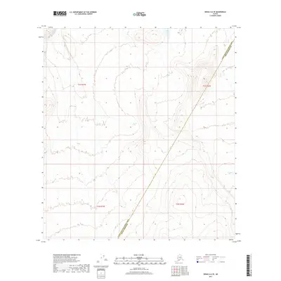
2017 Map of Denali A-6 SE
USGS Topo · Published 2017About this map
Slow Fork flows through the upper-left reaches of this interior Alaskan landscape, which is defined by high alpine ridges and a series of isolated mountain lakes. The topography reveals significant elevation changes, with Giles Lake situated in a high basin in the north and Barren Lake nestled within a central valley. Further southeast, Grizzly Lake sits among the contours of a distinct range. The map illustrates a transition between administrative zones, with the boundary between the Yukon-Koyukuk Census Area and Denali Borough cutting diagonally across the terrain. This document captures the wilderness in 2017, documenting a region devoid of roads or settlements, where name-bearing landmarks are restricted to the natural drainage systems and major bodies of water.
Find a feature on this map
9 named features on this map. Tap any name to fly to it.
Don’t see what you’re looking for? This feature index may not catch every label — zoom into the map to look around manually.
Map Details
Editions of this 2017 Denali A-6 SE Map
This is the sole edition of this map. No revisions or reprints were ever made.
Other maps of this area

1950 · Talkeetna
USGS Topo · 1:250,000

1951 · Talkeetna
USGS Topo · 1:250,000

1952 · Mount McKinley
USGS Topo · 1:250,000

1952 · Mount McKinley A-5
USGS Topo · 1:63,360

1954 · Mount McKinley A-5
USGS Topo · 1:63,360

1958 · Talkeetna D-6
USGS Topo · 1:63,360

1958 · Talkeetna D-5
USGS Topo · 1:63,360

1958 · Talkeetna
USGS Topo · 1:250,000

1958 · Mount McKinley A-6
USGS Topo · 1:63,360

1958 · Mount McKinley
USGS Topo · 1:250,000