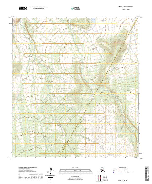
2023 Map of Denali A-6 SE
USGS Topo · Published 2023About this map
High-altitude wetlands and isolated glacial basins characterize this portion of the interior, situated along the administrative boundary of the Yukon-Koyukuk Census Area Denali Borough. The landscape is defined by its hydrography, where scattered water bodies like Giles Lake in the north and Barren Lake near the center provide clear markers amidst a complex network of drainage patterns. In the southeastern corner, Grizzly Lake sits tucked into a topographical pocket, reflecting the transitional nature of the terrain as it moves between different surveying townships. The map documents the precise alignment of township lines, including t21s r27w and t21s r26w, which carve the wilderness into a systematic grid despite the absence of established road infrastructure or named settlements.
Find a feature on this map
8 named features on this map. Tap any name to fly to it.
Don’t see what you’re looking for? This feature index may not catch every label — zoom into the map to look around manually.
Map Details
Editions of this 2023 Denali A-6 SE Map
This is the sole edition of this map. No revisions or reprints were ever made.
Other maps of this area

1950 · Talkeetna
USGS Topo · 1:250,000

1951 · Talkeetna
USGS Topo · 1:250,000

1952 · Mount McKinley
USGS Topo · 1:250,000

1952 · Mount McKinley A-5
USGS Topo · 1:63,360

1954 · Mount McKinley A-5
USGS Topo · 1:63,360

1958 · Talkeetna D-6
USGS Topo · 1:63,360

1958 · Talkeetna D-5
USGS Topo · 1:63,360

1958 · Talkeetna
USGS Topo · 1:250,000

1958 · Mount McKinley A-6
USGS Topo · 1:63,360

1958 · Mount McKinley
USGS Topo · 1:250,000