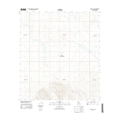
2015 Map of Denali B-3 SW
USGS Topo · Published 2015About this map
Denali National Park encompasses the majority of this interior landscape, where the terrain is defined by a dense network of high-altitude drainages. The hydrology of the region is centered on the winding path of Birch Creek, which is fed by numerous smaller tributaries like Birch Cr. In the eastern portion of the survey, the waters of Slippery Creek and its branch Slippery Cr flow alongside Iron Cr, carving through the elevation as they move northward. This 2015 study by the U.S. Geological Survey captures a wild environment devoid of human settlements or road infrastructure, instead highlighting the precise contours and the Public Land Survey System grid spanning townships such as t18s r20w and t19s r20w. It serves as a modern record of the pristine drainage patterns and topography within one of Alaska's most significant protected wilderness areas.
Find a feature on this map
12 named features on this map. Tap any name to fly to it.
Don’t see what you’re looking for? This feature index may not catch every label — zoom into the map to look around manually.
Map Details
Editions of this 2015 Denali B-3 SW Map
This is the sole edition of this map. No revisions or reprints were ever made.
Other maps of this area

1952 · Mount McKinley
USGS Topo · 1:250,000

1953 · Mount McKinley B-4
USGS Topo · 1:63,360

1953 · Mount McKinley B-3
USGS Topo · 1:63,360

1953 · Mount McKinley A-4
USGS Topo · 1:63,360

1954 · Mount McKinley A-4
USGS Topo · 1:63,360

1954 · Mount McKinley B-3
USGS Topo · 1:63,360

1954 · Mount McKinley A-3
USGS Topo · 1:63,360

1958 · Mount McKinley
USGS Topo · 1:250,000

1969 · Mount McKinley
USGS Topo · 1:250,000
2015 · Denali A-3 NE
USGS Topo · 1:25,000