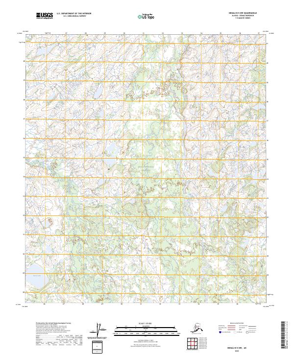
2023 Map of Denali B-5 NW
USGS Topo · Published 2023About this map
Denali National Preserve encompasses the entirety of this interior Alaska landscape, where the meandering course of the Herron River defines the central topography. This region is characterized by a dense network of watercourses and wetlands, with the Herron River fed by smaller tributaries like Wolf Creek. In the southwest corner, Burnt Lake sits near the headwaters of Highpower Creek, which flows northward through the western half of the quadrangle. The lack of roads or established settlements emphasizes the remote, untouched nature of this subarctic wilderness within the preserve boundaries. The intricate hydrography shown here reflects a landscape shaped by glacial runoff and the seasonal fluctuations of the river systems, providing a detailed look at the drainage patterns of the northern Denali region.
Find a feature on this map
12 named features on this map. Tap any name to fly to it.
Don’t see what you’re looking for? This feature index may not catch every label — zoom into the map to look around manually.
Map Details
Editions of this 2023 Denali B-5 NW Map
This is the sole edition of this map. No revisions or reprints were ever made.
Other maps of this area

1952 · Mount McKinley
USGS Topo · 1:250,000

1953 · Mount McKinley C-5
USGS Topo · 1:63,360

1953 · Mount McKinley B-5
USGS Topo · 1:63,360

1954 · Mount McKinley B-5
USGS Topo · 1:63,360

1954 · Mount McKinley C-5
USGS Topo · 1:63,360

1958 · Mount McKinley B-6
USGS Topo · 1:63,360

1958 · Mount McKinley C-6
USGS Topo · 1:63,360

1958 · Mount McKinley
USGS Topo · 1:250,000

1969 · Mount McKinley
USGS Topo · 1:250,000
2017 · Denali B-5 SW
USGS Topo · 1:25,000