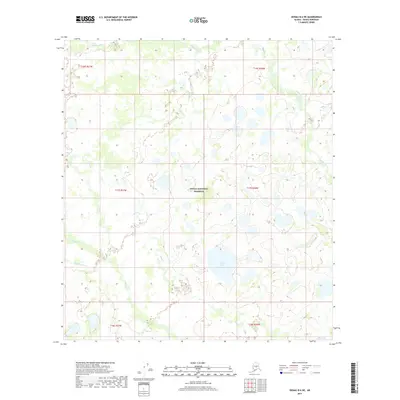
2017 Map of Denali B-6 NE
USGS Topo · Published 2017About this map
Denali National Preserve encompasses the central portion of this 2017 survey, revealing a landscape defined by an intricate network of waterways and glacial landforms. The terrain is dominated by the confluence of several key drainages, including Highpower Cr and Deep Cr, which carve through the northern and eastern sections. In the southwest, the Fish River and Shisnona River illustrate the complex hydrology of the region, flowing through a surface characterized by numerous kettle lakes and wetlands. Notable water bodies such as Carey Lake and the smaller Albert Lake are prominent features, likely serving as significant landmarks for those navigating this protected wilderness. The map provides a detailed view of the township and range divisions, such as t17s r27w and t17s r26w, which overlay the natural topography of the Alaska interior.
Find a feature on this map
13 named features on this map. Tap any name to fly to it.
Don’t see what you’re looking for? This feature index may not catch every label — zoom into the map to look around manually.
Map Details
Editions of this 2017 Denali B-6 NE Map
This is the sole edition of this map. No revisions or reprints were ever made.
Other maps of this area

1952 · Mount McKinley
USGS Topo · 1:250,000

1953 · Mount McKinley C-5
USGS Topo · 1:63,360

1953 · Mount McKinley B-5
USGS Topo · 1:63,360

1954 · Mount McKinley B-5
USGS Topo · 1:63,360

1954 · Mount McKinley C-5
USGS Topo · 1:63,360

1958 · Mount McKinley B-6
USGS Topo · 1:63,360

1958 · Mount McKinley C-6
USGS Topo · 1:63,360

1958 · Mount McKinley
USGS Topo · 1:250,000

1969 · Mount McKinley
USGS Topo · 1:250,000
2017 · Denali B-5 SW
USGS Topo · 1:25,000