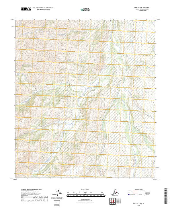
2023 Map of Denali C-1 NW
USGS Topo · Published 2023About this map
Denali National Park and the Denali Wilderness define this interior Alaskan landscape, characterized by an intricate network of glacial and snow-fed drainage systems. The survey identifies several significant watercourses, including the westward-flowing Little Moose Creek and Stampede Creek in the northern reaches, alongside the meandering Clearwater Fork and Stony Creek further south. The map provides a detailed view of the terrain before the major southern bend of Canyon Creek and its tributary, North Fork Canyon Creek, which navigate the elevation changes of the Alaska Range. This area remains largely undeveloped, preserving a wilderness character where natural hydrology like Moonlight Creek dictates the movement across the tundra and mountain foothills within the Denali Borough.
Find a feature on this map
15 named features on this map. Tap any name to fly to it.
Don’t see what you’re looking for? This feature index may not catch every label — zoom into the map to look around manually.
Map Details
Editions of this 2023 Denali C-1 NW Map
This is the sole edition of this map. No revisions or reprints were ever made.
Other maps of this area

1951 · Mount McKinley D-1
USGS Topo · 1:63,360

1952 · Mount McKinley
USGS Topo · 1:250,000

1952 · Mount McKinley C-1
USGS Topo · 1:63,360

1952 · Mount McKinley C-2
USGS Topo · 1:63,360

1954 · Mount McKinley D-2
USGS Topo · 1:63,360

1954 · Mount McKinley D-1
USGS Topo · 1:63,360

1954 · Mount McKinley C-1
USGS Topo · 1:63,360

1954 · Mount McKinley C-2
USGS Topo · 1:63,360

1958 · Mount McKinley
USGS Topo · 1:250,000

1969 · Mount McKinley
USGS Topo · 1:250,000