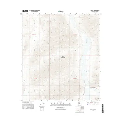
2015 Map of Denali C-1 SE
USGS Topo · Published 2015About this map
Denali National Park and the towering peaks of the Alaska Range dominate this interior landscape in the early twenty-first century. The map centers on the high-altitude terrain surrounding Mt Sheldon, where the Toklat River and its tributaries, including Sheldon Cr and Cabin Cr, carve through the glacial geography. The only significant corridor of human access is the Denali National Park Road, which snakes through the southeast corner of the quadrangle near the Toklat landmark. This road provides the essential link between the park's entrance and its deeper wilderness, passing near Divide Mtn. The topography here is characterized by steep elevation changes and natural drainages like Bear Draw and Stony Cr, illustrating the protected wilderness of the Alaska interior before the onset of modern climate shifts began to significantly alter the northern permafrost and glacial runoff patterns.
Find a feature on this map
15 named features on this map. Tap any name to fly to it.
Don’t see what you’re looking for? This feature index may not catch every label — zoom into the map to look around manually.
Map Details
Editions of this 2015 Denali C-1 SE Map
This is the sole edition of this map. No revisions or reprints were ever made.
Other maps of this area

1951 · Healy
USGS Topo · 1:250,000

1952 · Mount McKinley
USGS Topo · 1:250,000

1952 · Mount McKinley B-1
USGS Topo · 1:63,360

1952 · Mount McKinley C-1
USGS Topo · 1:63,360

1954 · Healy C-6
USGS Topo · 1:63,360

1954 · Healy B-6
USGS Topo · 1:63,360

1954 · Mount McKinley C-1
USGS Topo · 1:63,360

1954 · Mount McKinley B-1
USGS Topo · 1:63,360

1956 · Healy
USGS Topo · 1:250,000

1958 · Mount McKinley
USGS Topo · 1:250,000