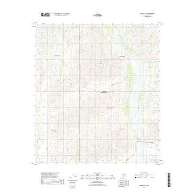
2019 Map of Denali C-1 SE
USGS Topo · Published 2019About this map
Denali National Park preserves a vast interior wilderness defined by high-elevation drainage systems and the prominent peak of Mt Sheldon. The landscape is dominated by the wide, braided course of the Toklat River, which flows northward through the eastern half of the quadrangle. Several smaller tributaries, including Sheldon Cr, Cabin Cr, and Stony Cr, carve through the complex topography, highlighting the natural erosion patterns of the subarctic environment.
Find a feature on this map
12 named features on this map. Tap any name to fly to it.
Don’t see what you’re looking for? This feature index may not catch every label — zoom into the map to look around manually.
Map Details
Editions of this 2019 Denali C-1 SE Map
This is the sole edition of this map. No revisions or reprints were ever made.
Other maps of this area

1951 · Healy
USGS Topo · 1:250,000

1952 · Mount McKinley
USGS Topo · 1:250,000

1952 · Mount McKinley B-1
USGS Topo · 1:63,360

1952 · Mount McKinley C-1
USGS Topo · 1:63,360

1954 · Healy C-6
USGS Topo · 1:63,360

1954 · Healy B-6
USGS Topo · 1:63,360

1954 · Mount McKinley C-1
USGS Topo · 1:63,360

1954 · Mount McKinley B-1
USGS Topo · 1:63,360

1956 · Healy
USGS Topo · 1:250,000

1958 · Mount McKinley
USGS Topo · 1:250,000