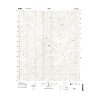
2015 Map of Denali C-2 NE
USGS Topo · Published 2015About this map
Denali National Park encompasses this interior Alaskan landscape, dominated by the high elevations of the Kantishna Hills. The terrain is defined by a dense network of high-latitude waterways, where Little Caribou Cr and Caribou Cr drain the northern and southern slopes respectively. Rising above the surrounding ridges, Pilgrim Peak serves as a primary landmark in this remote section of the park. The drainage patterns of N Fork Canyon Cr, Canyon Cr, and Moonlight Cr illustrate a complex system of deep valleys and sharp relief. This 2015 survey provides a modern topographical record of the protected wilderness, showing the precise township and range divisions including t14s r16w that organize this roadless environment.
Find a feature on this map
18 named features on this map. Tap any name to fly to it.
Don’t see what you’re looking for? This feature index may not catch every label — zoom into the map to look around manually.
Map Details
Editions of this 2015 Denali C-2 NE Map
This is the sole edition of this map. No revisions or reprints were ever made.
Other maps of this area

1951 · Mount McKinley D-1
USGS Topo · 1:63,360

1952 · Mount McKinley
USGS Topo · 1:250,000

1952 · Mount McKinley C-1
USGS Topo · 1:63,360

1952 · Mount McKinley C-2
USGS Topo · 1:63,360

1954 · Mount McKinley D-2
USGS Topo · 1:63,360

1954 · Mount McKinley D-1
USGS Topo · 1:63,360

1954 · Mount McKinley C-1
USGS Topo · 1:63,360

1954 · Mount McKinley C-2
USGS Topo · 1:63,360

1958 · Mount McKinley
USGS Topo · 1:250,000

1969 · Mount McKinley
USGS Topo · 1:250,000