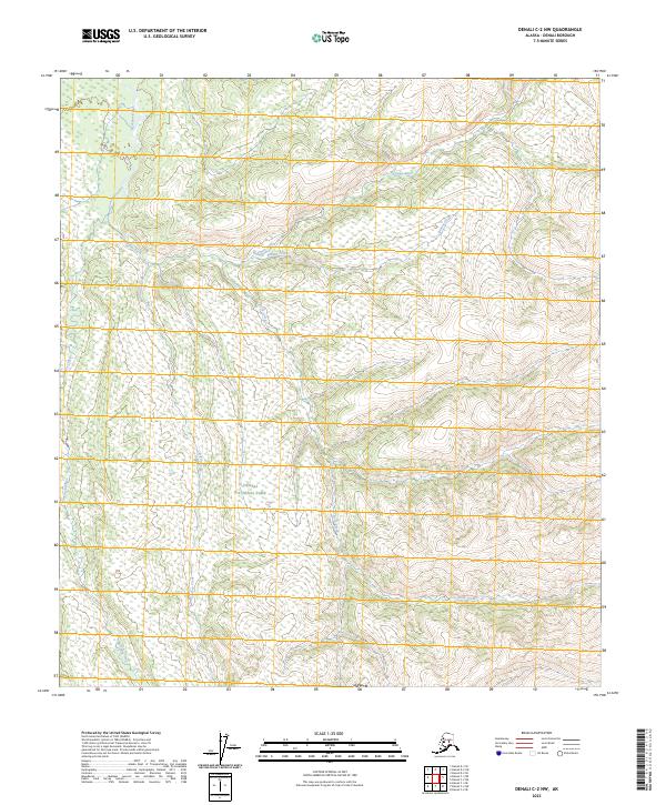
2023 Map of Denali C-2 NW
USGS Topo · Published 2023About this map
Denali National Park encompasses the majority of this interior Alaskan landscape, dominated by a complex network of glacial meltwater and mountain streams. The Bearpaw River winds through the northern sections of the quadrangle, joined by the tributaries of Beauty Creek and Caribou Creek. This high-latitude terrain is defined by its dramatic elevation changes and the raw hydrology of the subarctic, where drainage patterns like those of Glacier Creek and Rock Creek carve through the wilderness. Mapping this area in the early 2020s shows the contemporary extent of protected federal lands and the precise survey of remote townships, including portions of t14s r18w and t15s r17w, where the absence of roads or permanent settlements emphasizes the region's preservation as a vast natural corridor.
Find a feature on this map
12 named features on this map. Tap any name to fly to it.
Don’t see what you’re looking for? This feature index may not catch every label — zoom into the map to look around manually.
Map Details
Editions of this 2023 Denali C-2 NW Map
This is the sole edition of this map. No revisions or reprints were ever made.
Other maps of this area

1952 · Mount McKinley
USGS Topo · 1:250,000

1952 · Mount McKinley C-3
USGS Topo · 1:63,360

1952 · Mount McKinley C-2
USGS Topo · 1:63,360

1952 · Mount McKinley D-3
USGS Topo · 1:63,360

1954 · Mount McKinley D-2
USGS Topo · 1:63,360

1954 · Mount McKinley C-2
USGS Topo · 1:63,360

1958 · Mount McKinley
USGS Topo · 1:250,000

1969 · Mount McKinley
USGS Topo · 1:250,000
2015 · Denali D-2 SE
USGS Topo · 1:25,000
2015 · Denali C-3 SE
USGS Topo · 1:25,000