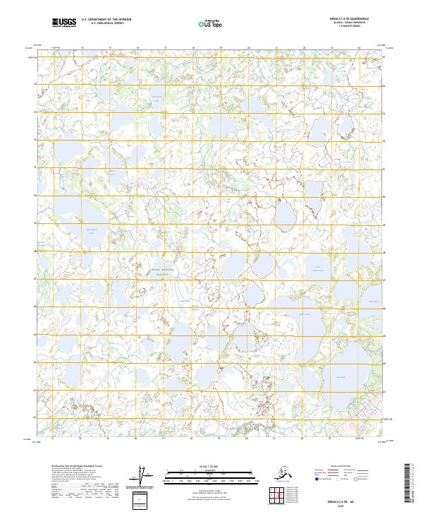
2023 Map of Denali C-6 SE
USGS Topo · Published 2023About this map
The Denali National Preserve encompasses most of this landscape, which is defined by an intricate network of glacial meltwater and stagnant ice depressions. The southern reach of the survey is dominated by the Herron Glacier, where ice and elevation contours give way to a vast lowland drainage system. This area is characterized by a high density of water bodies, including the aptly named Blackfish Lake, Moose Lake, and Sprucefish Lake, which illustrate the habitat diversity of the interior. The drainage pattern is largely dictated by Highpower Creek and Deep Creek, while larger basins such as Big Lake and Carls Cache Lake sit within the preserve's remote boundaries. This map provides a detailed view of the terrain before any major modern infrastructural development, focusing instead on the hydrography and natural features of the Alaskan subarctic.
Find a feature on this map
17 named features on this map. Tap any name to fly to it.
Don’t see what you’re looking for? This feature index may not catch every label — zoom into the map to look around manually.
Map Details
Editions of this 2023 Denali C-6 SE Map
This is the sole edition of this map. No revisions or reprints were ever made.
Other maps of this area

1952 · Mount McKinley
USGS Topo · 1:250,000

1953 · Mount McKinley C-5
USGS Topo · 1:63,360

1953 · Mount McKinley B-5
USGS Topo · 1:63,360

1954 · Mount McKinley B-5
USGS Topo · 1:63,360

1954 · Mount McKinley C-5
USGS Topo · 1:63,360

1958 · Mount McKinley B-6
USGS Topo · 1:63,360

1958 · Mount McKinley C-6
USGS Topo · 1:63,360

1958 · Mount McKinley
USGS Topo · 1:250,000

1969 · Mount McKinley
USGS Topo · 1:250,000
2017 · Denali C-6 NE
USGS Topo · 1:25,000