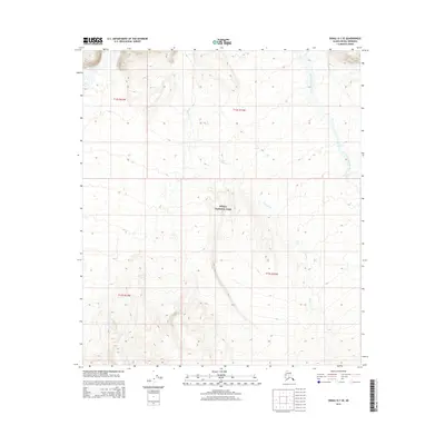
2015 Map of Denali D-1 SE
USGS Topo · Published 2015About this map
Denali National Park encompasses the central portion of this 2015 survey, where the glacial drainage systems of the Alaska Range define the land. The Toklat River flows through the northwestern corner, while the East Fork Toklat River moves through the eastern edge of the quadrangle. Between these two major arteries, Wigand Cr snakes through the central terrain, illustrating the intricate hydrology of the subarctic tundra. This map focuses on the high-elevation backcountry, away from established roads or settlements, detailing the natural topography of the park's interior. Researchers can trace the precise boundaries of several townships, including t13s r13w and t12s r14w, which overlay the protected wilderness areas.
Find a feature on this map
8 named features on this map. Tap any name to fly to it.
Don’t see what you’re looking for? This feature index may not catch every label — zoom into the map to look around manually.
Map Details
Editions of this 2015 Denali D-1 SE Map
This is the sole edition of this map. No revisions or reprints were ever made.
Other maps of this area

1951 · Healy
USGS Topo · 1:250,000

1951 · Mount McKinley D-1
USGS Topo · 1:63,360

1951 · Healy D-6
USGS Topo · 1:63,360

1952 · Mount McKinley
USGS Topo · 1:250,000

1952 · Mount McKinley C-1
USGS Topo · 1:63,360

1954 · Healy C-6
USGS Topo · 1:63,360

1954 · Mount McKinley D-1
USGS Topo · 1:63,360

1954 · Mount McKinley C-1
USGS Topo · 1:63,360
1954 · Healy D-6
USGS Topo · 1:63,360

1956 · Healy
USGS Topo · 1:250,000