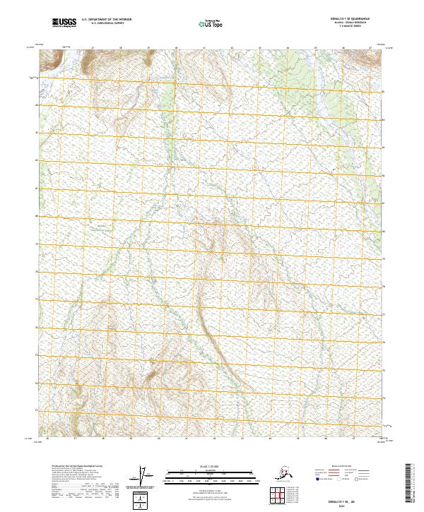
2023 Map of Denali D-1 SE
USGS Topo · Published 2023About this map
Denali National Park encompasses this high-latitude terrain, where the northern interior of Alaska remains largely undeveloped. This 2023 survey by the U.S. Geological Survey details a landscape shaped by powerful glacial and fluvial systems, most notably the braided channels of the Toklat River and the East Fork Toklat River as they flow northward. These river systems, along with the tributary Wigand Creek, define the drainage patterns of this subarctic environment. The boundary of the Denali Wilderness cuts across the southeast, marking a transition into an area of even stricter environmental protection. For those studying the geography of the Alaska Range, this map provides precise topographic data on the shifting riverbars and elevations that characterize the park's protected interior.
Find a feature on this map
9 named features on this map. Tap any name to fly to it.
Don’t see what you’re looking for? This feature index may not catch every label — zoom into the map to look around manually.
Map Details
Editions of this 2023 Denali D-1 SE Map
This is the sole edition of this map. No revisions or reprints were ever made.
Other maps of this area

1951 · Healy
USGS Topo · 1:250,000

1951 · Mount McKinley D-1
USGS Topo · 1:63,360

1951 · Healy D-6
USGS Topo · 1:63,360

1952 · Mount McKinley
USGS Topo · 1:250,000

1952 · Mount McKinley C-1
USGS Topo · 1:63,360

1954 · Healy C-6
USGS Topo · 1:63,360

1954 · Mount McKinley D-1
USGS Topo · 1:63,360

1954 · Mount McKinley C-1
USGS Topo · 1:63,360
1954 · Healy D-6
USGS Topo · 1:63,360

1956 · Healy
USGS Topo · 1:250,000