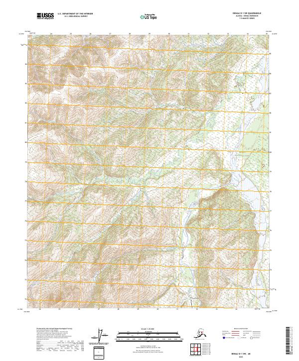
2023 Map of Denali D-1 SW
USGS Topo · Published 2023About this map
Denali National Park and the adjacent Denali Wilderness encompass the eastern portions of this landscape, where the braided channels of the Toklat River flow northward. This 2023 survey illustrates the drainage systems of the northern Alaska Range foothills, defined by numerous named watercourses such as Crooked Creek, Little Moose Creek, and the Clearwater Fork. In the southern reaches, the Stampede Airport provides a remote landing strip near the headwaters of Stampede Creek. The map details the complex topography and drainage basins of Little Caribou Creek and Morten Creek, providing an essential record of this preserved subarctic environment. The lack of road infrastructure outside of the backcountry airstrip emphasizes the protected and undeveloped nature of the Denali interior during the early 21st century.
Find a feature on this map
15 named features on this map. Tap any name to fly to it.
Don’t see what you’re looking for? This feature index may not catch every label — zoom into the map to look around manually.
Map Details
Editions of this 2023 Denali D-1 SW Map
This is the sole edition of this map. No revisions or reprints were ever made.
Other maps of this area

1951 · Mount McKinley D-1
USGS Topo · 1:63,360

1952 · Mount McKinley
USGS Topo · 1:250,000

1952 · Mount McKinley C-1
USGS Topo · 1:63,360

1952 · Mount McKinley C-2
USGS Topo · 1:63,360

1954 · Mount McKinley D-2
USGS Topo · 1:63,360

1954 · Mount McKinley D-1
USGS Topo · 1:63,360

1954 · Mount McKinley C-1
USGS Topo · 1:63,360

1954 · Mount McKinley C-2
USGS Topo · 1:63,360

1958 · Mount McKinley
USGS Topo · 1:250,000

1969 · Mount McKinley
USGS Topo · 1:250,000