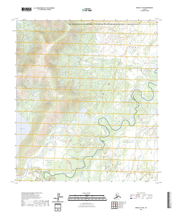
2023 Map of Denali D-3 NW
USGS Topo · Published 2023About this map
Kantishna River meanders sharply across this landscape, forming a complex network of oxbows and riparian wetlands that define the central and eastern portions of the terrain. The map captures the meeting of administrative boundaries, where the Denali National Park transition into the Denali National Preserve. This area is characterized by low-lying water features and subtle elevation changes, most notably at Chilchukabena Lake on the western edge. The lack of roads or permanent settlements highlights the protected, interior character of the region within Denali Co and Yukon-Koyukuk Co.
Find a feature on this map
10 named features on this map. Tap any name to fly to it.
Don’t see what you’re looking for? This feature index may not catch every label — zoom into the map to look around manually.
Map Details
Editions of this 2023 Denali D-3 NW Map
This is the sole edition of this map. No revisions or reprints were ever made.
Other maps of this area

1948 · Kantishna River
USGS Topo · 1:250,000

1951 · Kantishna River
USGS Topo · 1:250,000

1952 · Mount McKinley
USGS Topo · 1:250,000

1952 · Kantishna River A-3
USGS Topo · 1:63,360

1952 · Kantishna River
USGS Topo · 1:250,000

1952 · Mount McKinley D-3
USGS Topo · 1:63,360

1953 · Kantishna River A-4
USGS Topo · 1:63,360

1953 · Mount McKinley D-4
USGS Topo · 1:63,360

1953 · Kantishna River A-3
USGS Topo · 1:63,360

1954 · Mount McKinley D-4
USGS Topo · 1:63,360