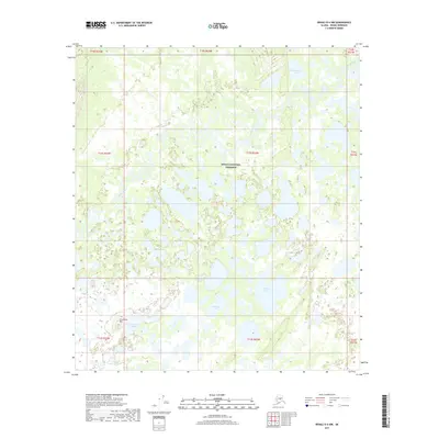
2017 Map of Denali D-4 NW
USGS Topo · Published 2017About this map
Denali National Preserve encompasses this vast wetland interior, where the Muddy River meanders through a complex network of unnamed oxbows and channels. This 2017 survey reveals a landscape dominated by hydrological patterns, with numerous small thaw lakes and larger named bodies such as Beaverlog Lakes and Gosling Lake dotting the terrain. The presence of Tso' Ch'ekan' Bene' and Sevenmile Hill provides rare topographic relief in an otherwise low-lying marshland. This map is an essential reference for understanding the shifting waterways and landforms of the Unorganized Borough at the start of the 21st century, illustrating how water dictates the geography of this protected wilderness south of the Muddy River corridor.
Find a feature on this map
7 named features on this map. Tap any name to fly to it.
Don’t see what you’re looking for? This feature index may not catch every label — zoom into the map to look around manually.
Map Details
Editions of this 2017 Denali D-4 NW Map
This is the sole edition of this map. No revisions or reprints were ever made.
Other maps of this area

1948 · Kantishna River
USGS Topo · 1:250,000

1951 · Kantishna River
USGS Topo · 1:250,000

1952 · Mount McKinley
USGS Topo · 1:250,000

1952 · Kantishna River
USGS Topo · 1:250,000

1952 · Kantishna River A-5
USGS Topo · 1:63,360

1953 · Kantishna River A-4
USGS Topo · 1:63,360

1953 · Mount McKinley D-5
USGS Topo · 1:63,360

1953 · Mount McKinley D-4
USGS Topo · 1:63,360

1954 · Mount McKinley D-4
USGS Topo · 1:63,360

1954 · Mount McKinley D-5
USGS Topo · 1:63,360