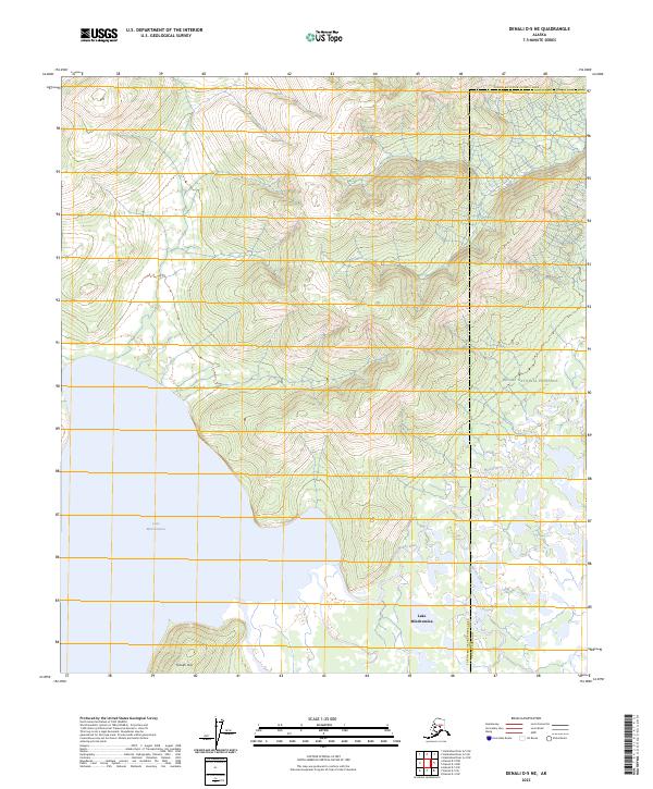
2023 Map of Denali D-5 NE
USGS Topo · Published 2023About this map
Lake Minchumina defines the southern reach of this interior landscape, where the waters of the Muddy River and Spence Creek converge in a sprawling wetland system. This modern survey illustrates the intersection of administrative boundaries, as the Denali National Preserve encompasses the eastern portion of the quadrangle while the Yukon-Koyukuk Census Area and Denali Borough meet in the northeast. The terrain is characterized by low-lying basin floor near the lake, rising toward the south at Yutokh Hill. The absence of roads or established settlements emphasizes the remote nature of this wilderness corridor, where the natural hydrography dictates the shape of the land and any potential historical travel routes.
Find a feature on this map
12 named features on this map. Tap any name to fly to it.
Don’t see what you’re looking for? This feature index may not catch every label — zoom into the map to look around manually.
Map Details
Editions of this 2023 Denali D-5 NE Map
This is the sole edition of this map. No revisions or reprints were ever made.
Other maps of this area

1948 · Kantishna River
USGS Topo · 1:250,000

1951 · Kantishna River
USGS Topo · 1:250,000

1952 · Mount McKinley
USGS Topo · 1:250,000

1952 · Kantishna River
USGS Topo · 1:250,000

1952 · Kantishna River A-5
USGS Topo · 1:63,360

1953 · Kantishna River A-4
USGS Topo · 1:63,360

1953 · Mount McKinley D-5
USGS Topo · 1:63,360

1953 · Mount McKinley D-4
USGS Topo · 1:63,360

1954 · Mount McKinley D-4
USGS Topo · 1:63,360

1954 · Mount McKinley D-5
USGS Topo · 1:63,360